
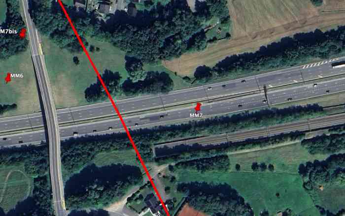
Fortifications belges de la deuxième guerre mondiale, position fortifiée de Liège, première ligne de résistance, intervalle Manaihant-Margarins, abri MM7. Détruit lors de la construction de l'autoroute. MM7 se trouvait à gauche de la route Battice-Verviers, 302 m/alt. À l’ancienne «intersection de la nationale et la route de Chaineux», son tir devait couvrir le vallon venant de l’est.
Belgische Festungen aus dem Zweiten Weltkrieg, verstärkte Stellung Lüttich, erste Widerstandslinie, Intervall Manaihant-Margarins, Unterstand MM7. Bei Autobahnbau zerstört. MM7 befand sich links der Straße Battice-Verviers, 302 m/ü. M. An der früheren "Kreuzung der Nationalstraße und der Straße nach Chaineux" sollte sein Feuer das von Osten kommende Tal abdecken.
Belgische fortificaties uit de Tweede Wereldoorlog, versterkte stelling Luik, eerste weerstandslijn, interval Manaihant-Margarins, schuilkelder MM7. Vernietigd tijdens de aanleg van de autosnelweg. MM7 bevond zich links van de weg Battice-Verviers, 302 m/TAW. Aan de voormalige "kruising van de nationale weg en de weg naar Chaineux" moest zijn vuur het dal komende vanuit het oosten dekken.
Belgian fortifications from the Second World War, fortified position of Liège, first line of resistance, interval Manaihant-Margarins, shelter MM7. Destroyed during motorway construction. MM7 was located to the left of the Battice-Verviers road, 302 m/asl. At the former "intersection of the national road and the road to Chaineux", its fire was to cover the valley coming from the east.
Belgické opevnění z druhé světové války, opevněná pozice Lutych, první linie odporu, interval Manaihant-Margarins, bunkr MM7. Zničen během výstavby dálnice. MM7 se nacházel vlevo od silnice Battice-Verviers, 302 m/n. m. Na bývalém "křižovatce státní silnice a silnice do Chaineux" měla jeho palba krýt údolí přicházející z východu.
