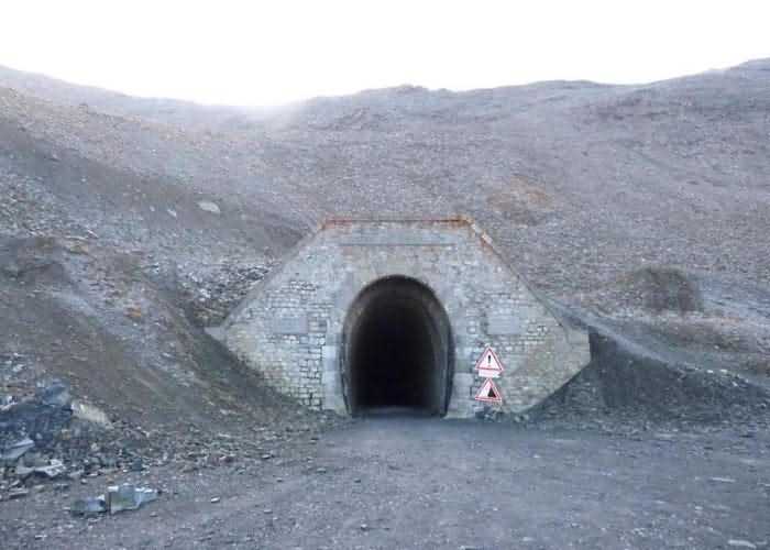
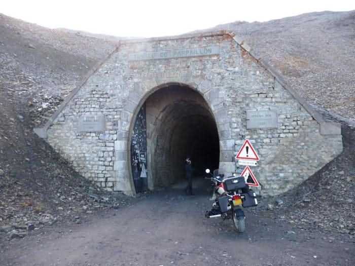
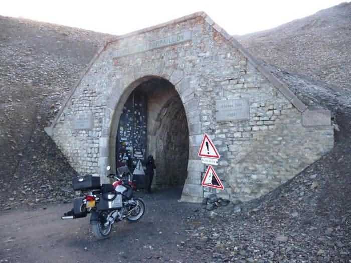
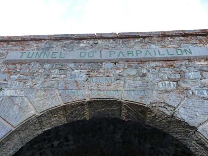
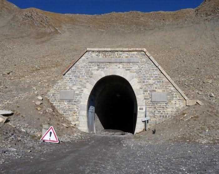
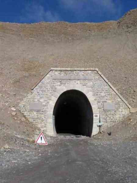
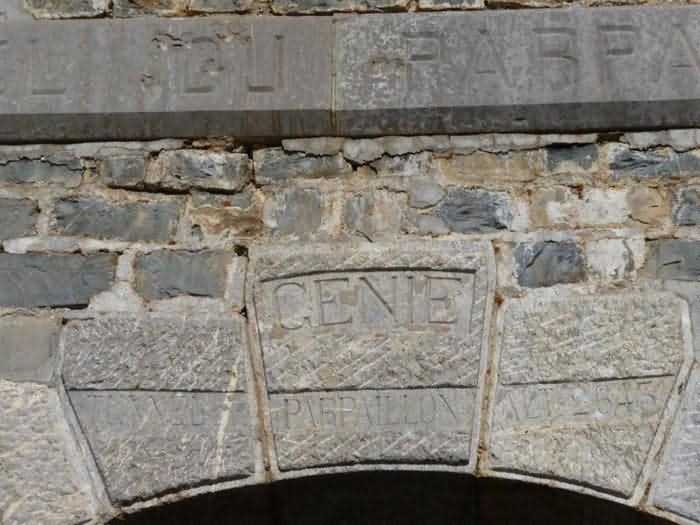
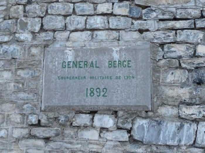
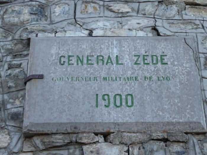
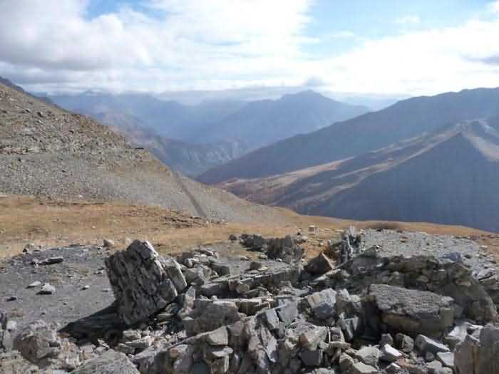
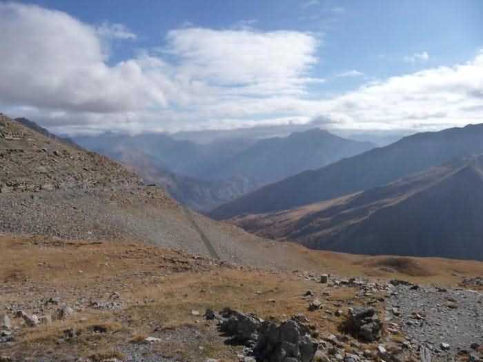
Place de Tournoux, nord-ouest de la place, 1892-1900. Ouvrage creusé sous le col du même nom, col passant à 2783 m/alt, pour joindre aisément Tournoux à Embrun. Cité pour mémoire. Les coordonnées géographiques ci-dessus indiquent l'emplacement de l'entrée sud du tunnel.
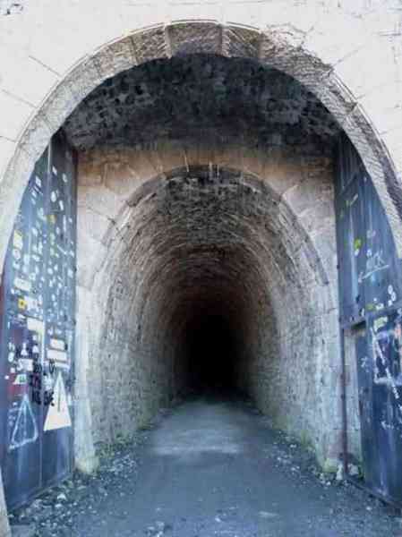
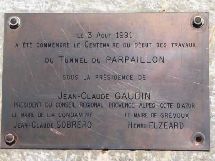
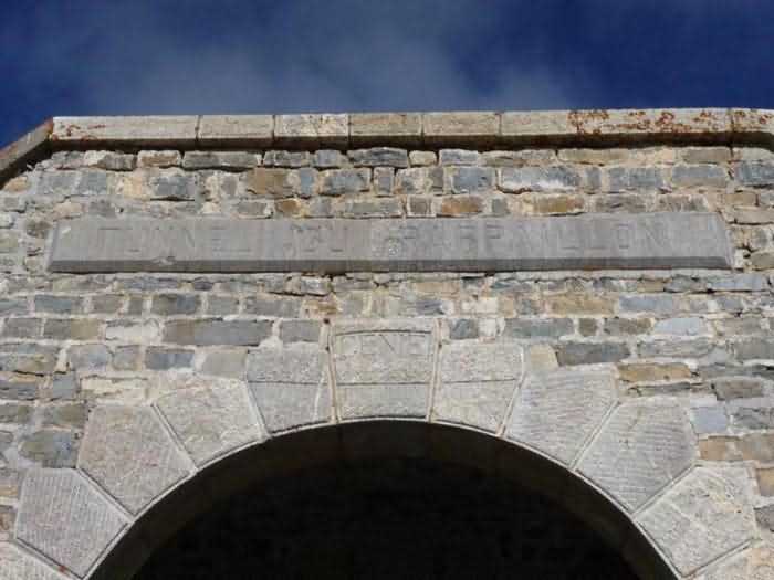
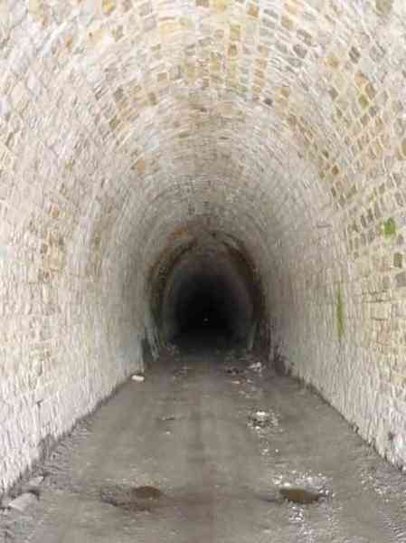
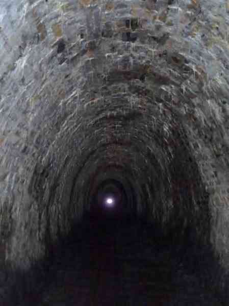
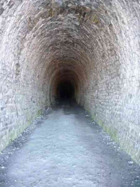
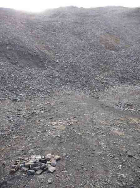
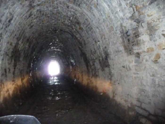
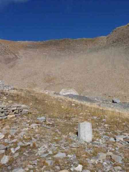
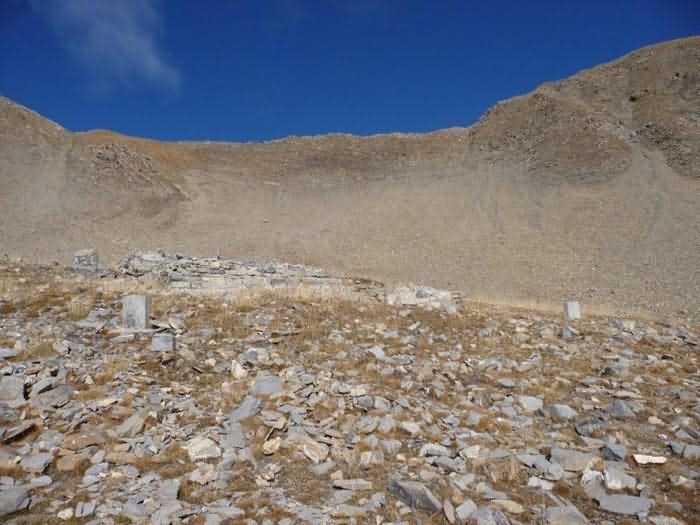
Les plaques commémoratives des deux généraux sont identiques cotés sud ou nord, la seule différence étant qu'au sud, il n'y a plus d'encre pour lire les inscriptions, sans doute à cause du soleil. Les frontons nord et sud sont identiques. Le sol du tunnel est en terre, particulièrement boueux à certains endroits. Le passage en moto était assez délicat. Il y a aux deux extrémités des portes métalliques qui n'ont plus été manœuvrées depuis des années. Heureusement, d'ailleurs! A proximité de l'entrée sud se trouvent les ruines d'un petit bâtiment qui devait servir de casernement pendant la réalisation des travaux, je pense. On peut distinguer quelques ouvertures à vocation militaire, plutôt sur l'extrémité ouest. Ca ressemble à des archères. Il n'y a aucunes traces de tuiles ou de poutres dans les décombres, ce qui me fait penser que le bâtiment était entièrement maçonné, fait de liant et de pierres… Renseignement pratique: si un jour vous envisagez d'aller jusqu'au tunnel, sachez que la montée par le versant sud est, à l'heure actuelle, possible en voiture normale sans aucune difficulté. Il faut juste s'armer de patience. Compter une petite dizaine de kilomètres de piste tout à fait carrossable. Ne pas tenter la montée par temps humide, ça serait voué à l'échec. La vue est extraordinaire. Et en moto, c'est magnifique! (P.G. 10/2008)
Festung von Tournoux, nordwestlich der Festung, 1892-1900. Unter dem gleichnamigen Pass, Pass auf 2783 M ü M, gegrabenes Werk, um Tournoux leicht mit Embrun zu verbinden. Zum Gedächtnis angeführt. Die oben angegebenen geografischen Koordinaten geben den Standort des südlichen Tunneleingangs an.
Die Gedenktafeln der beiden Generäle sind auf der Süd- oder Nordseite identisch, der einzige Unterschied besteht darin, dass im Süden keine Tinte mehr zum Lesen der Inschriften vorhanden ist, wahrscheinlich wegen der Sonne. Die Nord- und Südgiebel sind identisch. Der Tunnelboden ist aus Erde, besonders an einigen Stellen schlammig. Die Durchfahrt mit dem Motorrad war ziemlich heikel. An beiden Enden gibt es Metalltore, die seit Jahren nicht mehr betätigt wurden. Zum Glück übrigens! In der Nähe des Südeingangs befinden sich die Ruinen eines kleinen Gebäudes, das, denke ich, während der Bauarbeiten als Unterkunft gedient haben muss. Man kann einige Öffnungen militärischer Bestimmung unterscheiden, eher am Westende. Es sieht aus wie Schießscharten. Es gibt keine Spuren von Ziegeln oder Balken in den Trümmern, was mich denken lässt, dass das Gebäude vollständig gemauert war, aus Bindemittel und Steinen… Praktische Auskunft: Wenn Sie eines Tages in Erwägung ziehen, zum Tunnel zu gehen, wissen Sie, dass der Aufstieg über die Südseite derzeit mit einem normalen Auto ohne Schwierigkeiten möglich ist. Man muss sich nur in Geduld üben. Mit etwa zehn Kilometern durchaus befahrbarer Piste rechnen. Versuchen Sie den Aufstieg nicht bei feuchtem Wetter, das wäre zum Scheitern verurteilt. Die Aussicht ist außergewöhnlich. Und mit dem Motorrad ist es großartig! (P.G. 10/2008)
Vesting van Tournoux, noordwest van de vesting, 1892-1900. Werk uitgegraven onder de gelijknamige pas, pas op 2783 m/alt, om Tournoux gemakkelijk met Embrun te verbinden. Vermeld voor de herinnering. De bovenstaande geografische coördinaten geven de locatie van de zuidelijke tunnel ingang aan.
De gedenkplaten van de twee generaals zijn identiek aan zuid- of noordkant, het enige verschil is dat in het zuiden er geen inkt meer is om de inscripties te lezen, zonder twijfel door de zon. De noord- en zuidfrontons zijn identiek. De tunnelbodem is van aarde, bijzonder modderig op bepaalde plaatsen. De doorgang met de motor was vrij delicaat. Er zijn aan beide uiteinden metalen deuren die sinds jaren niet meer bediend zijn. Gelukkig trouwens! In de nabijheid van de zuidingang bevinden zich de ruïnes van een klein gebouw dat, denk ik, als kazernering moet gediend hebben tijdens de uitvoering van de werken. Men kan enkele openingen met militaire bestemming onderscheiden, eerder op het westuiteinde. Het lijkt op schietgaten. Er zijn geen sporen van tegels of balken in het puin, wat me doet denken dat het gebouw volledig gemetseld was, gemaakt van bindmiddel en stenen… Praktische inlichting: als u ooit overweegt naar de tunnel te gaan, weet dan dat de beklimming via de zuidflank op dit ogenblik mogelijk is met een normale wagen zonder enige moeilijkheid. Men moet zich alleen met geduld wapenen. Rekenen op een kleine tien kilometer geheel berijdbare piste. Niet proberen de beklimming bij vochtig weer, het zou tot mislukken gedoemd zijn. Het uitzicht is buitengewoon. En met de motor is het magnifiek! (P.G. 10/2008)
Fortress of Tournoux, north-west of the fortress, 1892-1900. Work dug under the pass of the same name, pass at 2783 m/alt, to easily join Tournoux to Embrun. Cited for memory. The geographical coordinates above indicate the location of the south entrance of the tunnel.
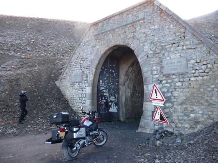
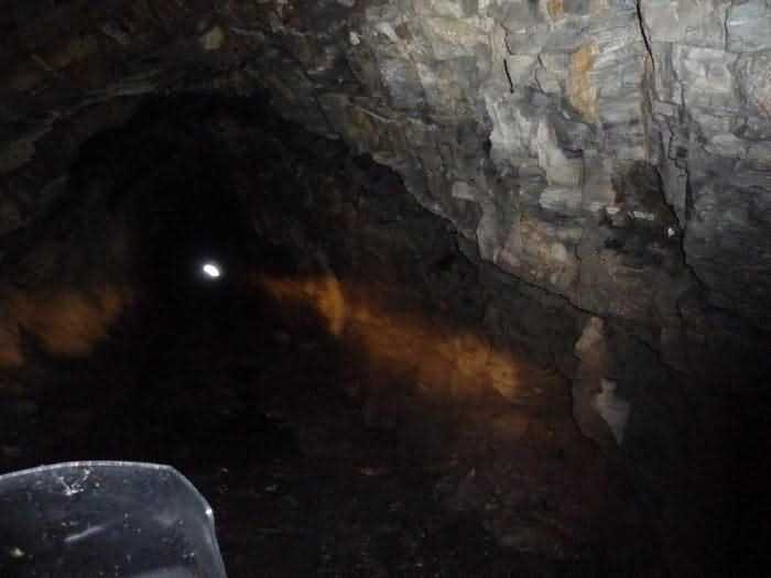
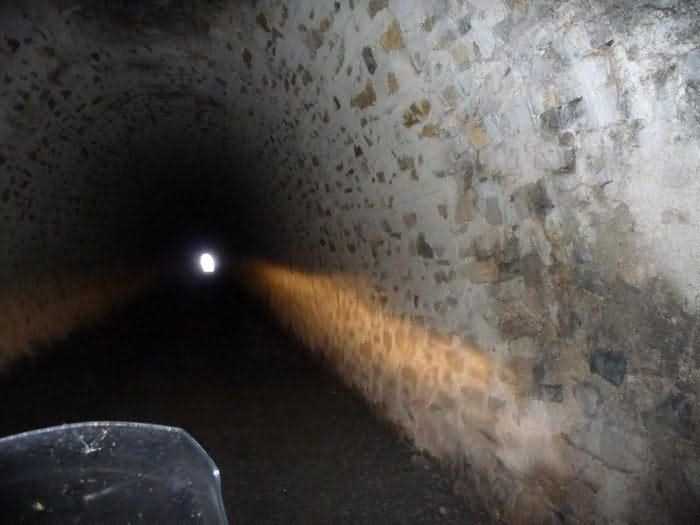
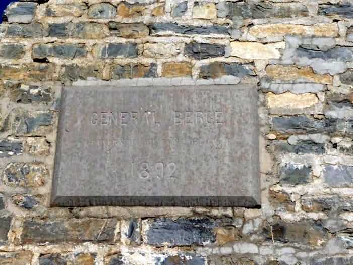
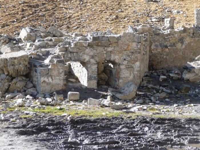
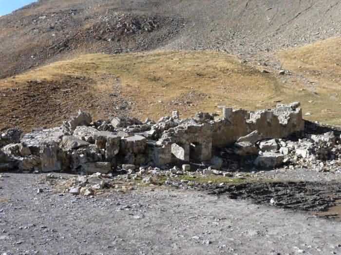
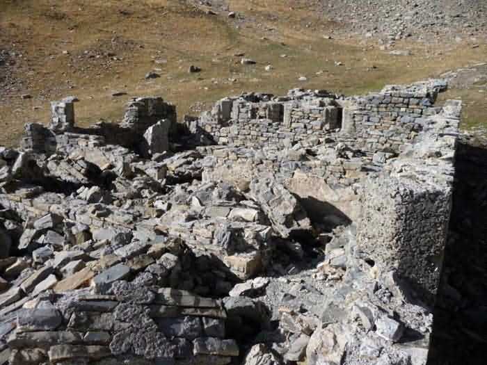
The commemorative plaques of the two generals are identical on south or north sides, the only difference being that in the south, there is no more ink to read the inscriptions, doubtless because of the sun. The north and south pediments are identical. The tunnel floor is earthen, particularly muddy in some places. The passage by motorcycle was quite delicate. There are at both ends metal doors that have not been operated for years. Fortunately, by the way! Near the south entrance are the ruins of a small building that must have served as barracks during the execution of the works, I think. One can distinguish some openings with military purpose, rather on the west end. It looks like arrow slits. There are no traces of tiles or beams in the debris, which makes me think that the building was entirely masonry, made of binder and stones… Practical information: if one day you consider going to the tunnel, know that the ascent by the south slope is, at the present time, possible by normal car without any difficulty. One must only arm oneself with patience. Count about ten kilometers of quite passable track. Do not attempt the ascent in wet weather, it would be doomed to failure. The view is extraordinary. And by motorcycle, it is magnificent! (P.G. 10/2008)
Pevnost Tournoux, severozápadně od pevnosti, 1892-1900. Dílo vyhloubené pod stejnojmenným průsmykem, průsmyk v 2783 m/n.m., aby snadno spojilo Tournoux s Embrun. Uvedeno pro paměť. Výše uvedené zeměpisné souřadnice udávají umístění jižního vstupu tunelu.
Pamětní desky dvou generálů jsou identické na jižní nebo severní straně, jediný rozdíl je, že na jihu již není inkoust k přečtení nápisů, bezpochyby kvůli slunci. Severní a jižní frontony jsou identické. Podlaha tunelu je z hlíny, na některých místech obzvláště bahnitá. Průjezd na motocyklu byl dost choulostivý. Na obou koncích jsou kovové dveře, které nebyly ovládány roky. Naštěstí mimochodem! V blízkosti jižního vstupu se nacházejí ruiny malé budovy, která, myslím, musela sloužit jako ubytovna během provádění prací. Lze rozeznat několik otvorů s vojenským určením, spíše na západním konci. Vypadá to jako střílny. V sutinách nejsou žádné stopy po taškách nebo trámech, což mě vede k domněnce, že budova byla zcela zděná, z pojiva a kamenů… Praktická informace: pokud si jednoho dne budete přát jít k tunelu, vězte, že výstup po jižním svahu je v současné době možný normálním autem bez jakýchkoli obtíží. Je třeba se pouze vyzbrojit trpělivostí. Počítejte s asi deseti kilometry zcela sjízdné cesty. Nepokoušejte se o výstup za vlhkého počasí, bylo by to odsouzeno k neúspěchu. Výhled je mimořádný. A na motocyklu je to nádhera! (P.G. 10/2008)