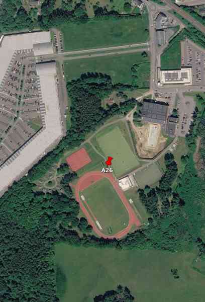
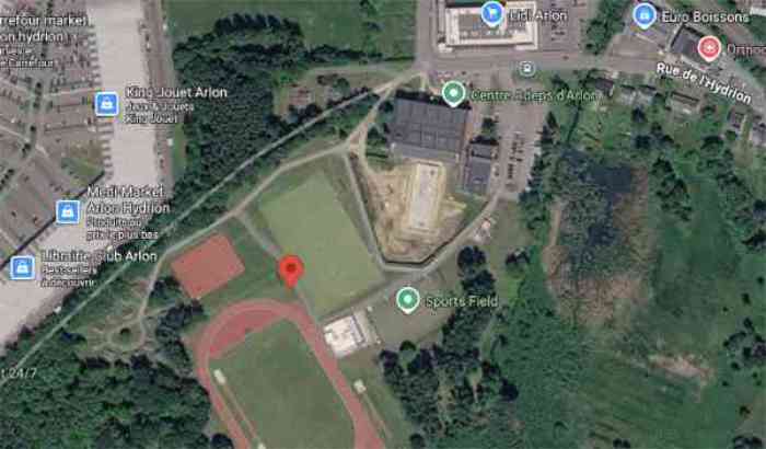
A26 (abri CR Arlon)[a226][49.682597, 5.792725]
🌎
Arlon.
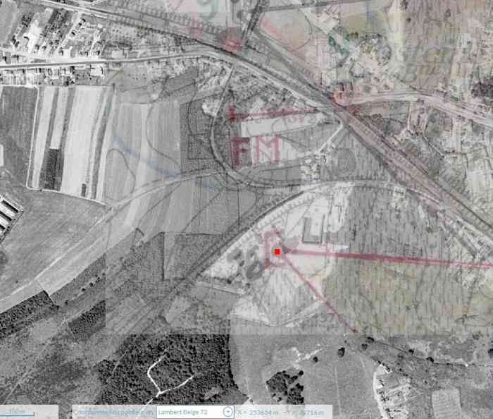
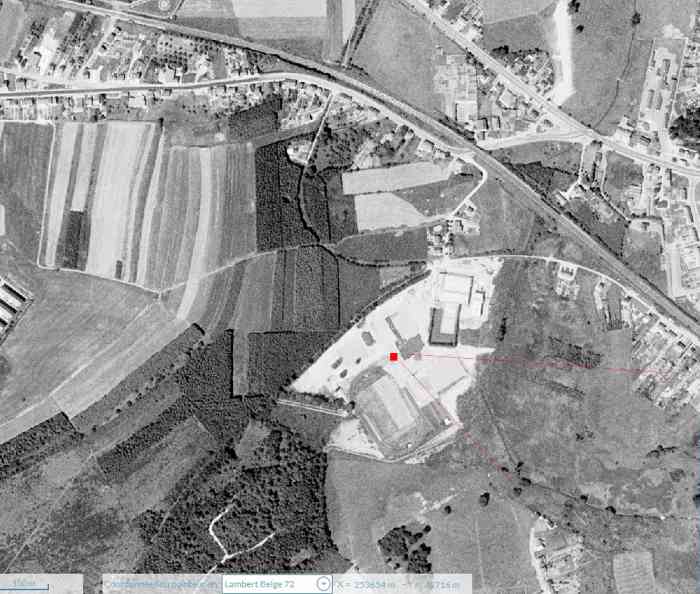
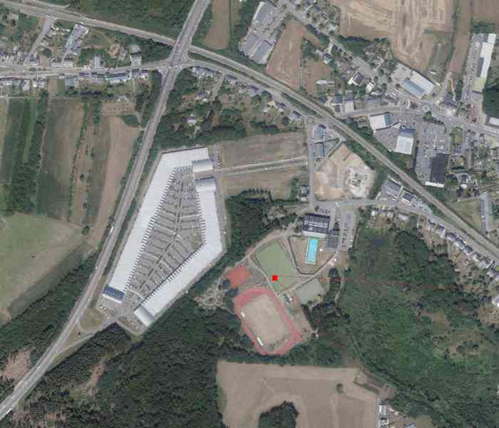
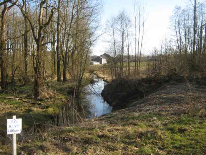
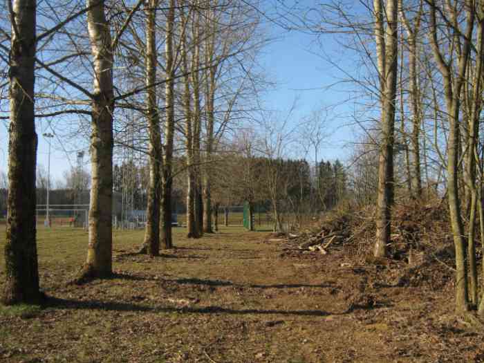
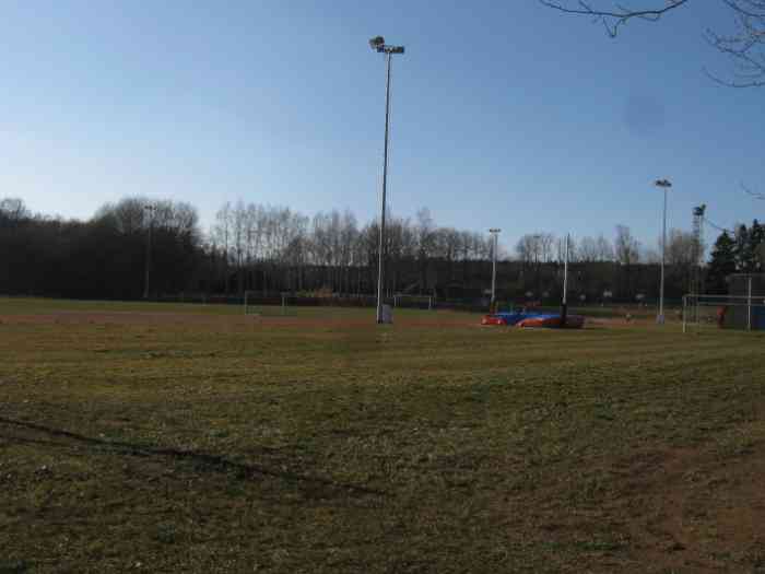
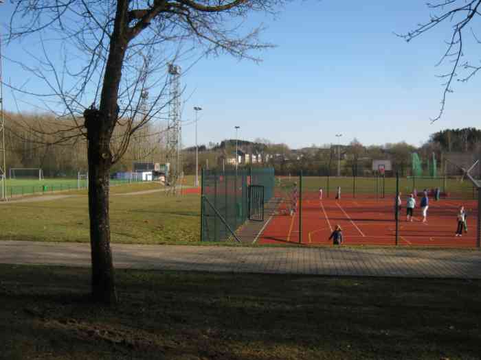
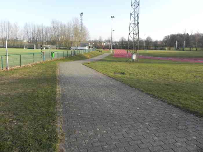
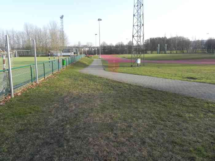
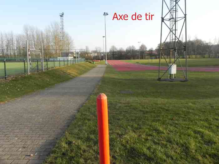
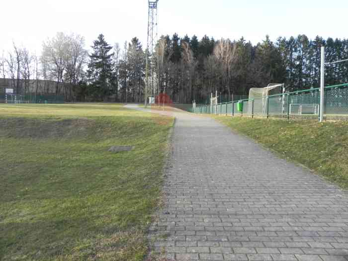
Fortifications belges de la deuxième guerre mondiale, première ligne de résistance, position avancée d’Arlon, abri A26 de type PA modèle indéterminé, 371 m/alt, situé à l’ouest de la ville, Rue de l’Hydrion, enterré sous le stade multi-sports de l’ADEPS (Administration de l’Éducation physique, du Sport).
Belgische Befestigungen des Zweiten Weltkriegs, erste Widerstandslinie, vorgeschobene Stellung von Arlon, Unterstand A26 vom Typ PA Modell unbestimmt, 371 M/ü M, gelegen westlich der Stadt in der Rue de l’Hydrion, unter dem Mehrzwecksportstadion der ADEPS (Verwaltung für Körpererziehung und Sport) vergraben.
Belgische versterkingen uit de Tweede Wereldoorlog, eerste weerstandslijn, vooruitgeschoven stelling van Aarlen, schuilkelder A26 van type PA model onbepaald, 371 m/TAW, gelegen ten westen van de stad, Rue de l’Hydrion, begraven onder het multisportstadion van de ADEPS (Administratie voor Lichamelijke Opvoeding en Sport).
Belgian fortifications of the Second World War, first line of resistance, advanced position of Arlon, shelter A26 of type PA indeterminate model, 371 m/asl, located west of the city, Rue de l’Hydrion, buried under the multi‑sports stadium of the ADEPS (Administration of Physical Education and Sport).
Belgické opevnění z druhé světové války, první linie odporu, předsunuté postavení Arlon, bunkr A26 typu PA model neurčený, 371 m/n. m, nacházející se západně od města v ulici Rue de l’Hydrion, zasypaný pod víceúčelovým sportovním stadionem ADEPS (Správa tělesné výchovy a sportu).
JPu 11/05/2026
- 09/06/2026
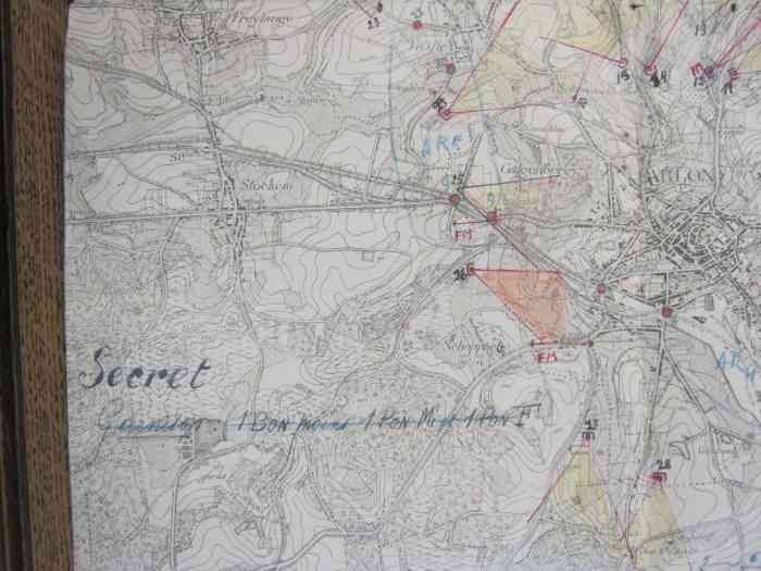
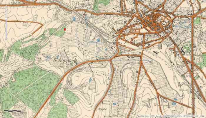
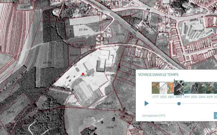
L’abri A 26 se situait sur la commune de Heinsch. Cadastre : Heinsch section C parcelle 2322i de 0,90 are. L’emprise militaire était délimitée par la présence à ses angles par des bornes DN (Défense Nationale) qui étaient en majorité au nombre de quatre. Pour A 26 les bornes ne sont plus visibles, détruites ou remblayées. Abri PA type inconnu, camouflage local en blocs de béton et toit en éternit probablement à deux pans au vu des documents MRA. Il tirait dans la direction est‑sud‑est et couvrait le sud de la ligne de chemin de fer de Luxembourg 162. D’après les cartes l’abri devait se trouver à l’orée d’un petit bois. Le reste est inconnu. Lors de ma visite, j’ai essayé de trouver l’emplacement de A 26, je compte, pour l’emplacement, sur une erreur de 0 à 20 m. A 26 a été détruit ou remblayé au moment de la construction du centre sportif Adeps de l’Hydrion, celui‑ci a été construit entre 1968 et inauguré en 1973.
Der Unterstand A 26 befand sich in der Gemeinde Heinsch. Kataster: Heinsch Sektion C Parzelle 2322i von 0,90 Are. Die militärische Einfriedung wurde durch die an ihren Ecken vorhandenen DN‑Grenzsteine (Landesverteidigung) begrenzt, von denen es in der Regel vier gab. Für A 26 sind die Grenzsteine nicht mehr sichtbar, zerstört oder zugeschüttet. Unterstand PA unbekannten Typs, örtliche Tarnung mit Betonblöcken und Eternitdach, wahrscheinlich Satteldach, laut MRA‑Dokumenten. Er feuerte in Richtung Ost‑Südost und deckte den Süden der Eisenbahnlinie von Luxemburg 162 ab. Laut Karten sollte der Unterstand am Rande eines kleinen Waldes liegen. Der Rest ist unbekannt. Bei meinem Besuch versuchte ich, den Standort von A 26 zu finden; ich gehe für den Standort von einem Fehler von 0 bis 20 m aus. A 26 wurde beim Bau des Sportzentrums Adeps de l’Hydrion zerstört oder zugeschüttet; dieses wurde zwischen 1968 erbaut und 1973 eingeweiht.
De schuilkelder A 26 bevond zich in de gemeente Heinsch. Kadaster: Heinsch sectie C perceel 2322i van 0,90 are. De militaire omheining werd begrensd door de aanwezigheid op haar hoeken van DN‑grenspalen (Nationale Verdediging), die meestal vier in aantal waren. Voor A 26 zijn de grenspalen niet meer zichtbaar, vernietigd of vergraven. Schuilkelder PA type onbekend, lokale camouflage met betonblokken en eterniet dak, waarschijnlijk zadeldak, volgens de MRA‑documenten. Hij vuurde in oost‑zuidoostelijke richting en bestreek het zuiden van de spoorlijn van Luxemburg 162. Volgens de kaarten moest de schuilkelder aan de rand van een klein bos liggen. De rest is onbekend. Tijdens mijn bezoek probeerde ik de locatie van A 26 te vinden; ik schat voor de locatie een fout van 0 tot 20 m. A 26 werd vernietigd of vergraven tijdens de bouw van het sportcentrum Adeps de l’Hydrion, dat tussen 1968 werd gebouwd en in 1973 werd ingehuldigd.
Shelter A 26 was located in the municipality of Heinsch. Cadastre: Heinsch section C parcel 2322i of 0.90 are. The military enclosure was delimited by the presence at its corners of DN boundary stones (National Defence), which were mostly four in number. For A 26 the boundary stones are no longer visible, destroyed or filled in. PA shelter of unknown type, local camouflage with concrete blocks and Eternit roof, probably gabled, according to MRA documents. It fired in an east‑southeast direction and covered the south of the Luxembourg railway line 162. According to maps, the shelter should have been at the edge of a small wood. The rest is unknown. During my visit, I tried to find the location of A 26; I estimate for the location an error of 0 to 20 m. A 26 was destroyed or filled in during the construction of the Adeps de l’Hydrion sports centre, which was built between 1968 and inaugurated in 1973.
Bunkr A 26 se nacházel v obci Heinsch. Katastr: Heinsch sekce C parcela 2322i o výměře 0,90 aru. Vojenský prostor byl vymezen přítomností hraničních kamenů DN (Národní obrana) na jeho rozích, kterých byla většinou čtyři. U A 26 nejsou hraniční kameny již viditelné, zničené nebo zasypané. Bunkr PA neznámého typu, místní maskování betonovými bloky a střecha z eternitu, pravděpodobně sedlová, podle dokumentů MRA. Střílel směrem východo‑jihovýchodně a kryl jih železniční trati z Lucemburska 162. Podle map měl být bunkr na okraji malého lesa. Zbytek je neznámý. Během své návštěvy jsem se pokusil najít umístění A 26, pro umístění počítám s chybou 0 až 20 m. A 26 byl zničen nebo zasypán během výstavby sportovního centra Adeps de l’Hydrion, které bylo postaveno mezi rokem 1968 a slavnostně otevřeno v roce 1973.
© Francis Pluymers