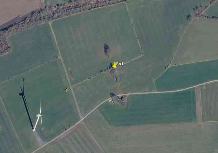
Bo1 (abri CR Bourcy)[bo1][50.052844, 5.800601]
🌎
Longvilly.
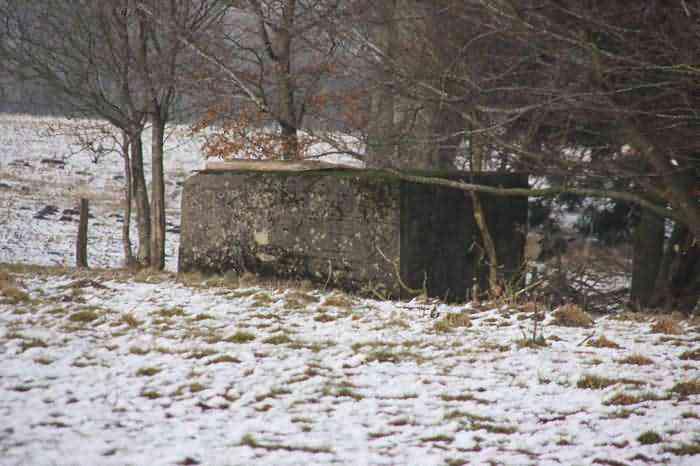
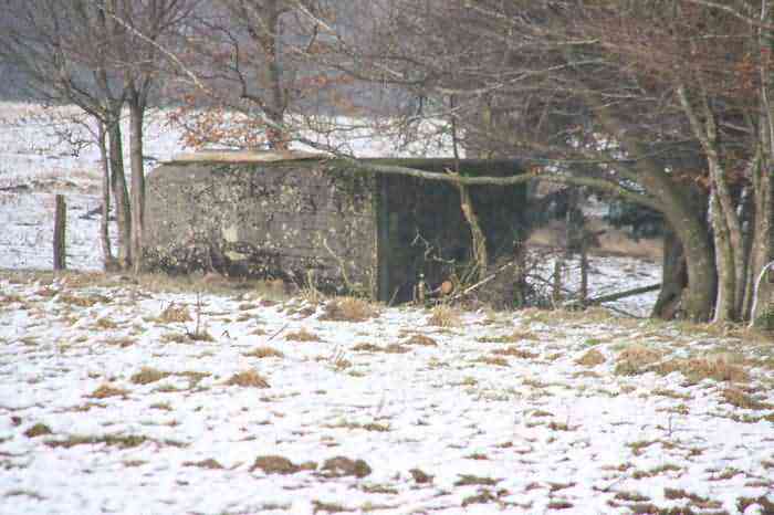
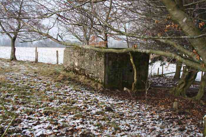
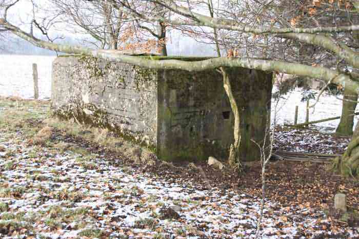
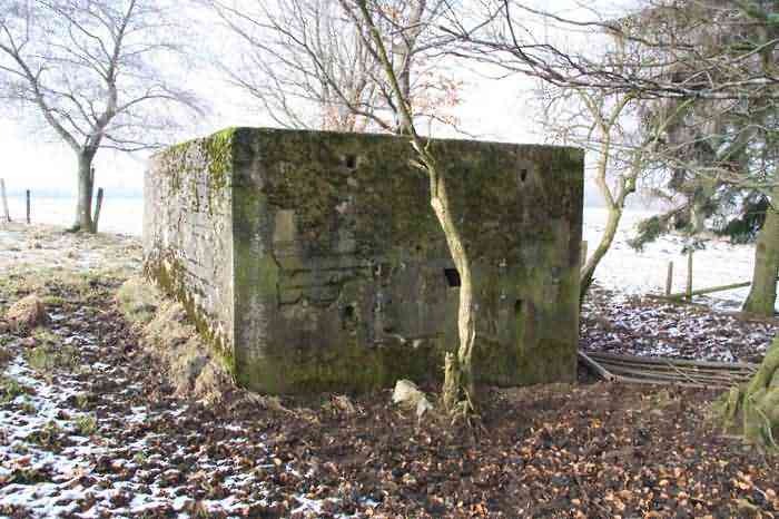
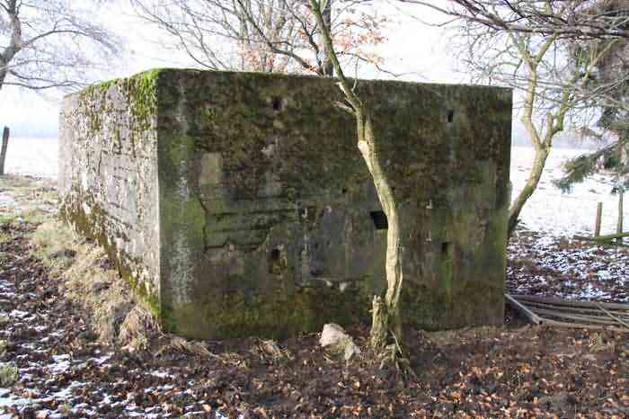
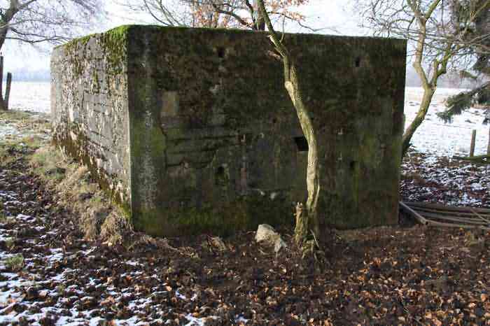
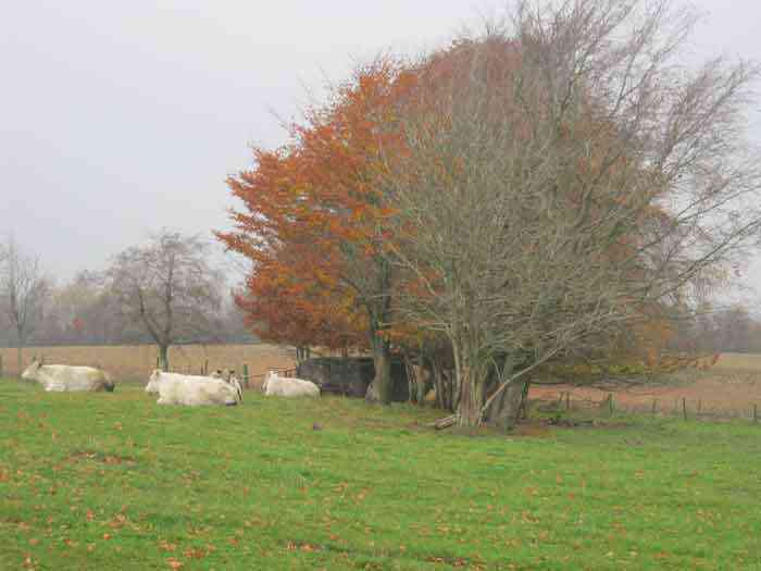
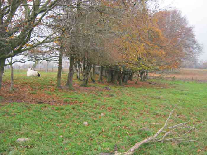
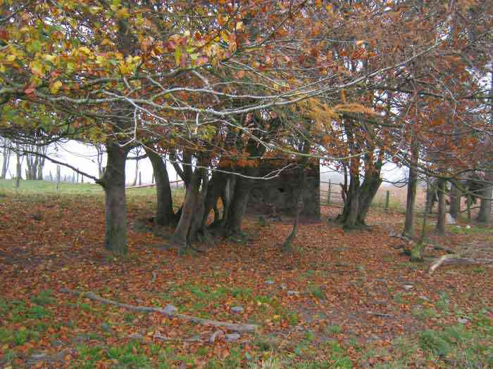
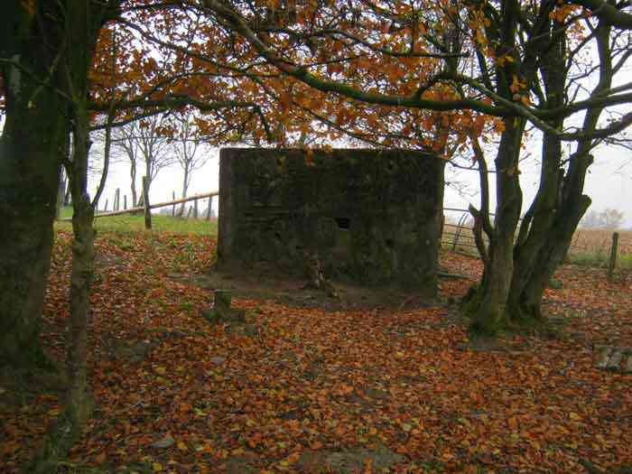
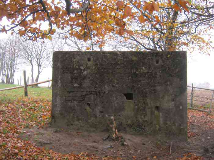
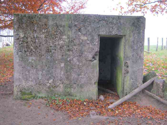
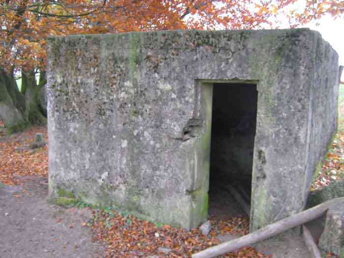
Fortifications belges de la deuxième guerre mondiale, première ligne de résistance, direction des travaux de fortification Liège/Luxembourg (DTF), position avancée de Bourcy, abri Bo1 de type PA modèle C, 533 m/alt, situé dans un champ sous un bouquet d’arbres à 380 m à l’ouest de la Route Nationale 838, à 800 m au sud-ouest du village de Bourcy.
Belgische Befestigungen des Zweiten Weltkriegs, erste Widerstandslinie, Direktion der Befestigungsarbeiten Lüttich/Luxemburg (DTF), vorgeschobene Stellung von Bourcy, Unterstand Bo1 vom Typ PA Modell C, 533 M/ü M, gelegen in einem Feld unter einem Baumwäldchen, 380 m westlich der Nationalstraße 838, 800 m südwestlich des Dorfes Bourcy.
Belgische versterkingen uit de Tweede Wereldoorlog, eerste weerstandslijn, directie van de vestingswerken Luik/Luxemburg (DTF), vooruitgeschoven stelling van Bourcy, schuilkelder Bo1 van type PA model C, 533 m/TAW, gelegen in een veld onder een bosje bomen, 380 m ten westen van de Nationale Weg 838, 800 m ten zuidwesten van het dorp Bourcy.
Belgian fortifications of the Second World War, first line of resistance, Fortification Works Directorate Liège/Luxembourg (DTF), advanced position of Bourcy, shelter Bo1 of type PA model C, 533 m/asl, located in a field under a clump of trees, 380 m west of National Route 838, 800 m southwest of the village of Bourcy.
Belgické opevnění z druhé světové války, první linie odporu, ředitelství opevňovacích prací Lutych/Lucembursko (DTF), předsunuté postavení Bourcy, bunkr Bo1 typu PA model C, 533 m/n. m, nacházející se na poli pod skupinou stromů, 380 m západně od Národní silnice 838, 800 m jihozápadně od vesnice Bourcy.
JPu 23/06/2026
- 02/10/2011
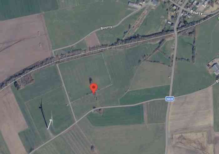
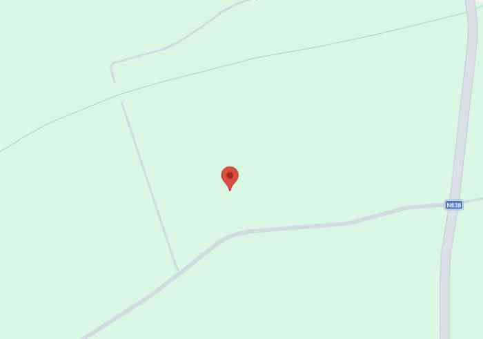
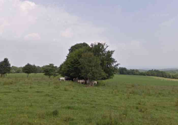
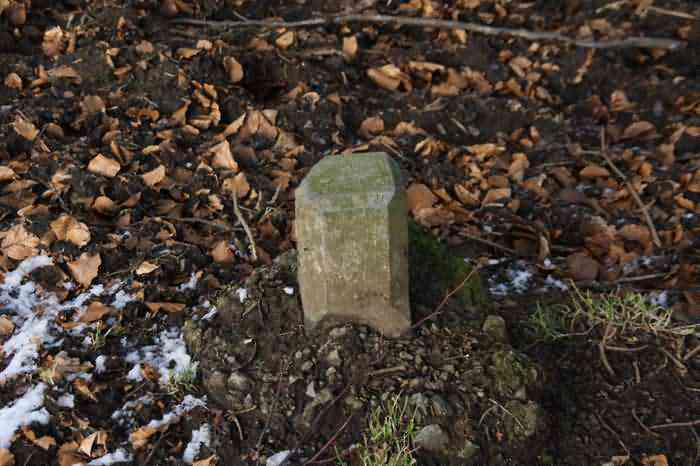
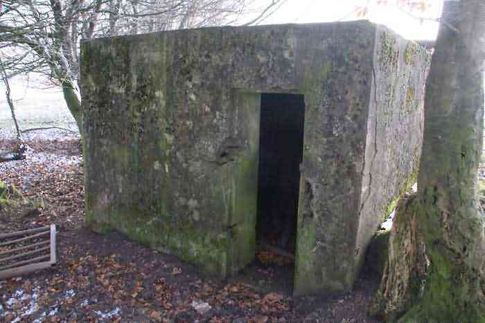
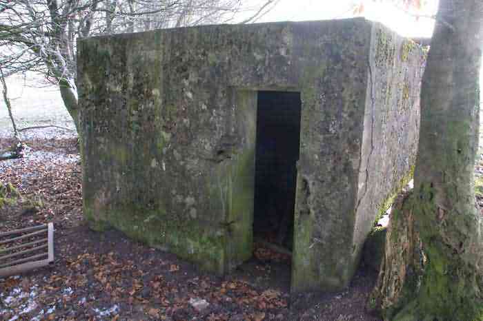
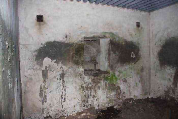
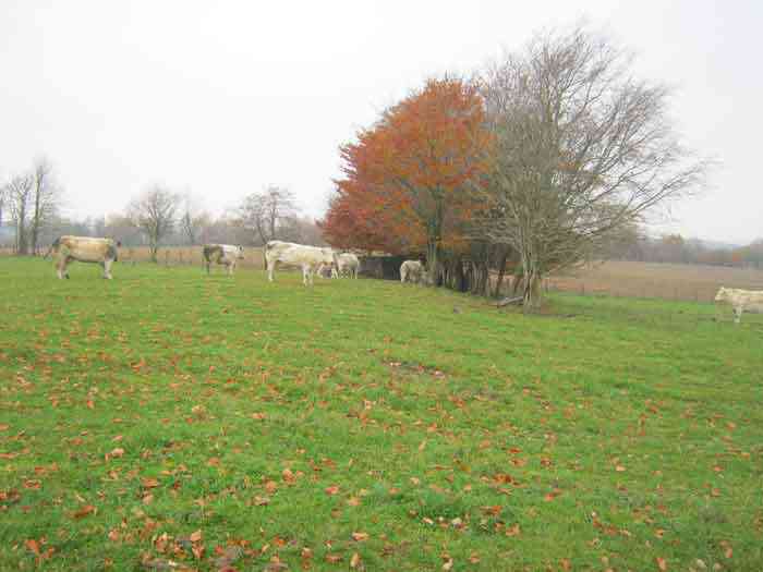
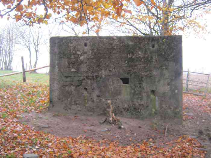
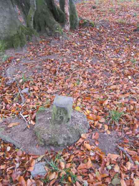
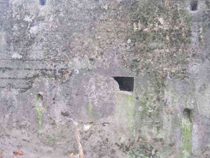
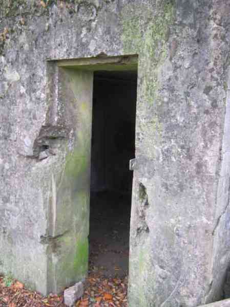
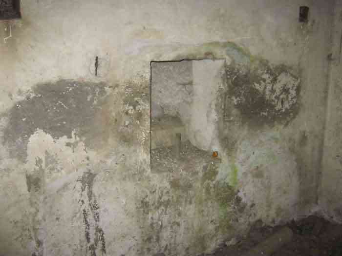
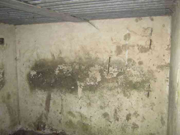
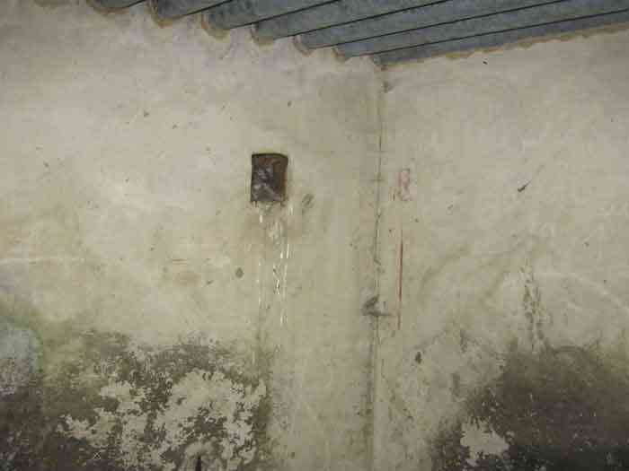
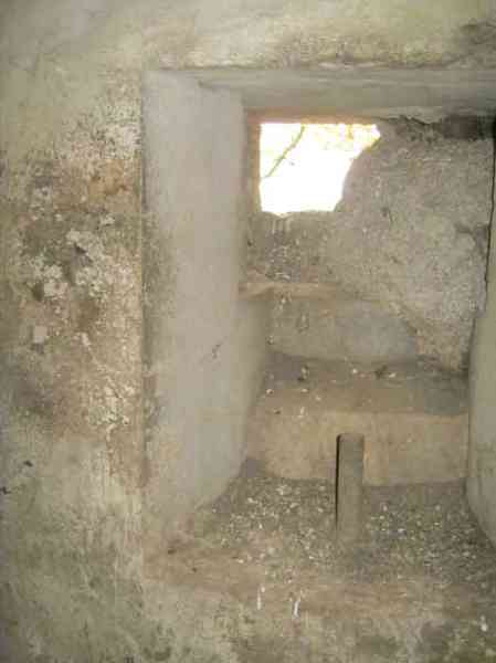
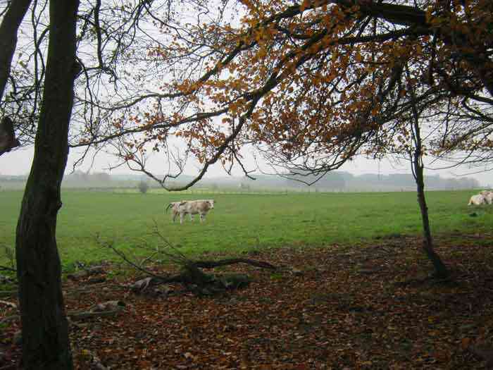
Bourcy 1 se trouve au milieu des pâturages situé au sud du village. Il est à 200 m au sud de l’ancienne ligne et couvrait la N838 venant de Michamps. État extérieur et intérieur bons. L’embrasure est murée et avait un volet pivotant maintenant disparu. L’entrée est accessible. Affût Chardome (disparu). Pas de goulottes lance‑grenades. Il reste 3 bornes DN autour de l’abri.
Bourcy 1 befindet sich mitten in den Weiden südlich des Dorfes. Er liegt 200 m südlich der alten Linie und deckte die N838 aus Richtung Michamps ab. Äußerer und innerer Zustand gut. Die Schießscharte ist zugemauert und hatte einen Schwenkladen, der nun verschwunden ist. Der Eingang ist zugänglich. Chardome‑Lafette (verschwunden). Keine Granatwurfschleusen. Es sind noch 3 DN‑Grenzsteine um den Unterstand vorhanden.
Bourcy 1 bevindt zich midden in de weiden ten zuiden van het dorp. Het ligt op 200 m ten zuiden van de oude lijn en bestreek de N838 komende van Michamps. Buiten‑ en binnenkant in goede staat. Het schietgat is dichtgemetseld en had een draaiende luik die nu verdwenen is. De ingang is toegankelijk. Chardôme‑affuit (verdwenen). Geen granaatgoten. Er zijn nog 3 DN‑grenspalen rond de schuilkelder.
Bourcy 1 is located in the middle of the pastures south of the village. It is 200 m south of the old line and covered the N838 coming from Michamps. Exterior and interior condition good. The embrasure is walled up and had a pivoting shutter now disappeared. The entrance is accessible. Chardome mount (disappeared). No grenade chutes. 3 DN boundary stones remain around the shelter.
Bourcy 1 se nachází uprostřed pastvin jižně od vesnice. Je 200 m jižně od staré linie a kryl silnici N838 přicházející z Michamps. Vnější a vnitřní stav dobrý. Střílna je zazděná a měla výklopnou klapku, která nyní zmizela. Vchod je přístupný. Lafeta Chardôme (zmizela). Žádné granátové skluzy. Kolem bunkru zůstávají 3 hraniční kameny DN.
© Francis Pluymers