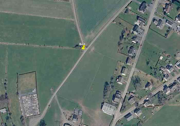
Bo4 (abri CR Bourcy)[bo3][50.062866, 5.811621]
🌎
Longvilly.
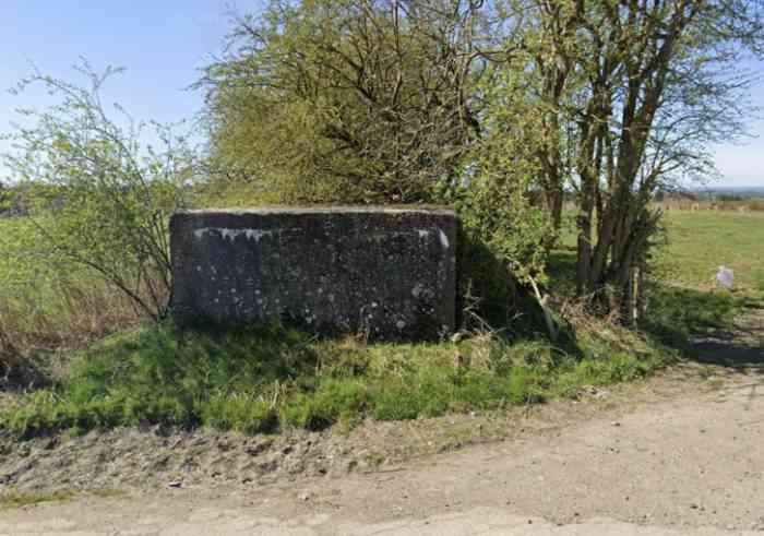
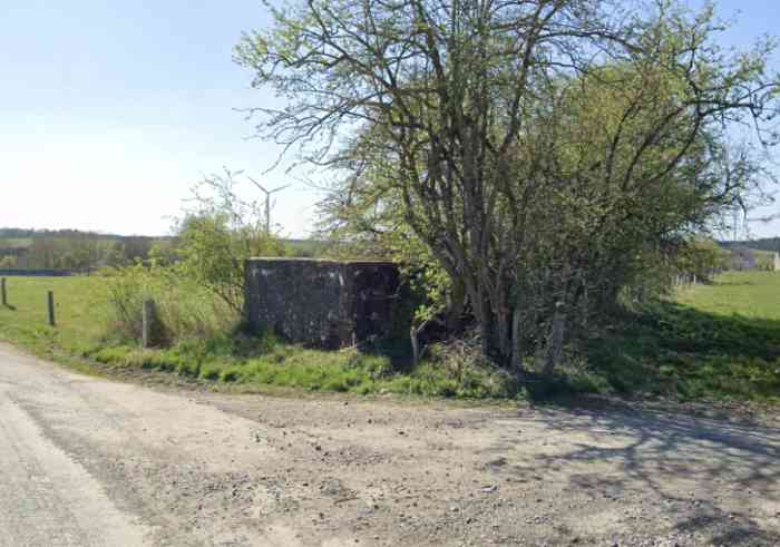
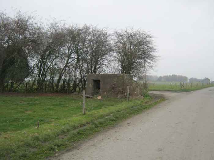
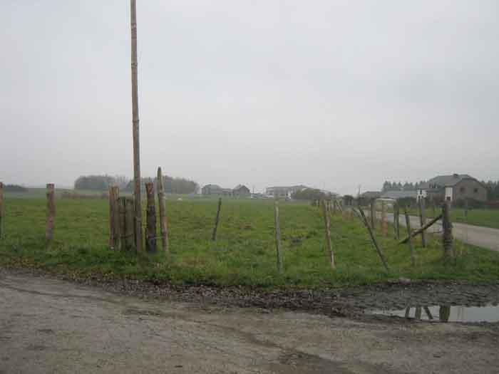
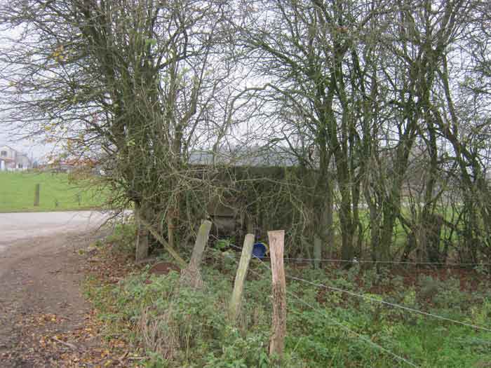
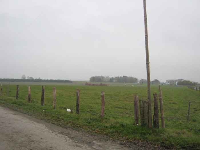
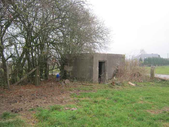
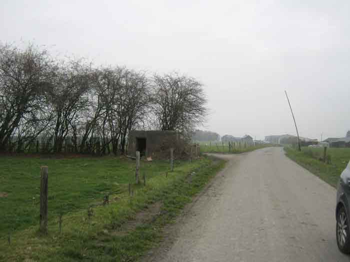
Fortifications belges de la deuxième guerre mondiale, première ligne de résistance, direction des travaux de fortification Liège/Luxembourg (DTF), position avancée de Bourcy, abri Bo4 de type PA modèle A, 518 m/alt, situé dans un pré sous un bouquet d’arbres en bordure de route après le cimetière, à 500 m au nord-nord-est du centre du village et à 340 m à l’ouest de Bo3.
Belgische Befestigungen des Zweiten Weltkriegs, erste Widerstandslinie, Direktion der Befestigungsarbeiten Lüttich/Luxemburg (DTF), vorgeschobene Stellung von Bourcy, Unterstand Bo4 vom Typ PA Modell A, 518 M/ü M, gelegen in einer Wiese unter einem Baumwäldchen am Straßenrand nach dem Friedhof, 500 m nordnordöstlich des Dorfzentrums und 340 m westlich von Bo3.
Belgische versterkingen uit de Tweede Wereldoorlog, eerste weerstandslijn, directie van de vestingswerken Luik/Luxemburg (DTF), vooruitgeschoven stelling van Bourcy, schuilkelder Bo4 van type PA model A, 518 m/TAW, gelegen in een weide onder een bosje bomen langs de weg na het kerkhof, 500 m ten noordnoordoosten van het dorpscentrum en 340 m ten westen van Bo3.
Belgian fortifications of the Second World War, first line of resistance, Fortification Works Directorate Liège/Luxembourg (DTF), advanced position of Bourcy, shelter Bo4 of type PA model A, 518 m/asl, located in a meadow under a clump of trees by the roadside after the cemetery, 500 m north-northeast of the village centre and 340 m west of Bo3.
Belgické opevnění z druhé světové války, první linie odporu, ředitelství opevňovacích prací Lutych/Lucembursko (DTF), předsunuté postavení Bourcy, bunkr Bo4 typu PA model A, 518 m/n. m, nacházející se na louce pod skupinou stromů při okraji silnice za hřbitovem, 500 m severoseverovýchodně od centra vesnice a 340 m západně od Bo3.
JPu 23/06/2026
- 02/10/2011
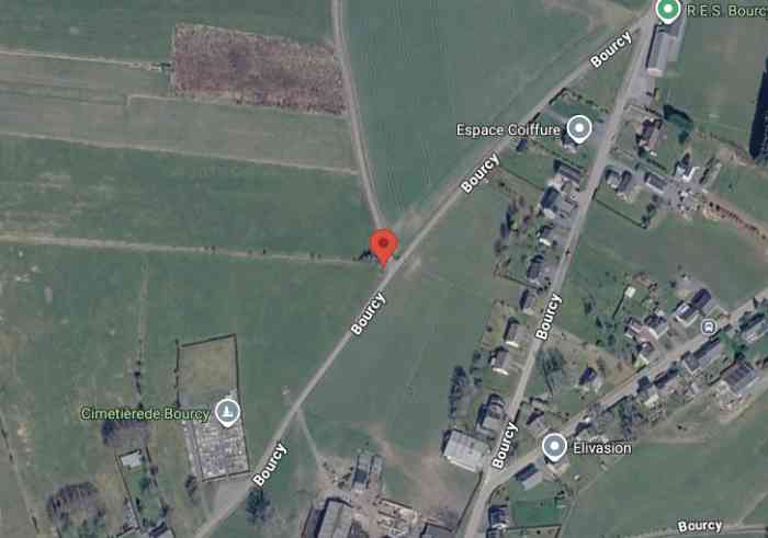
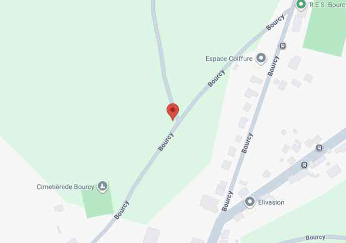
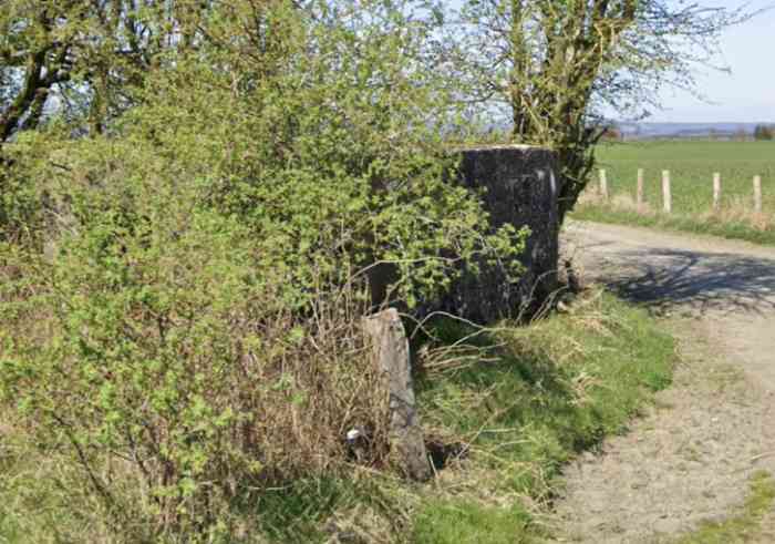
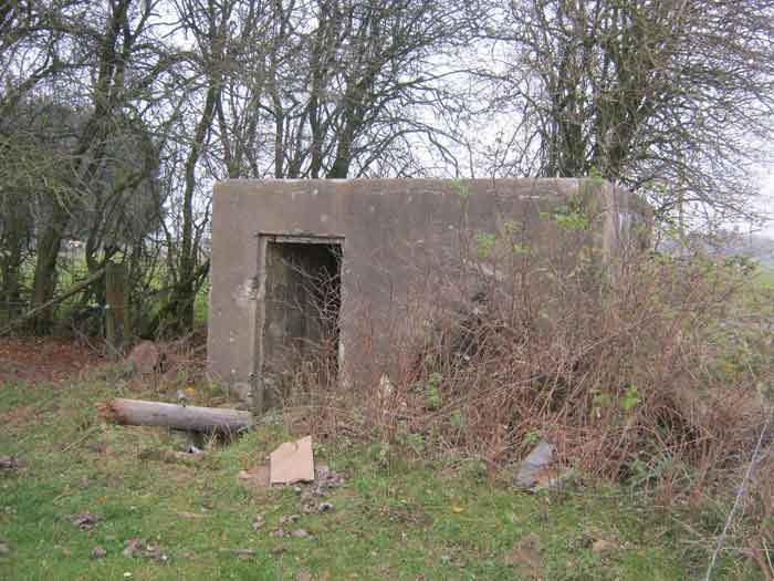
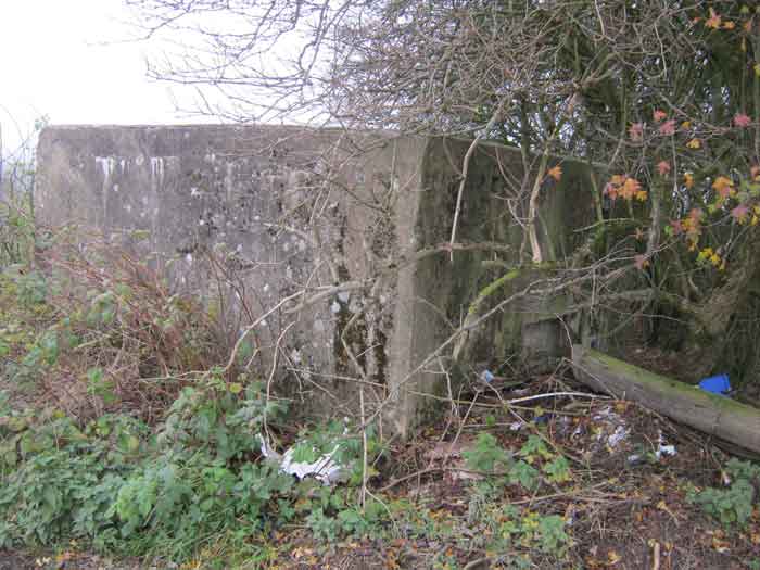
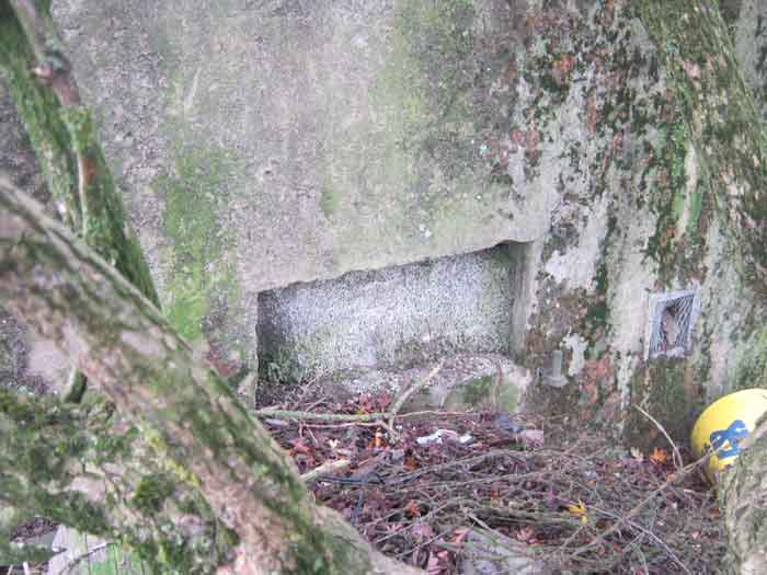
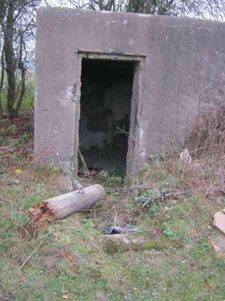
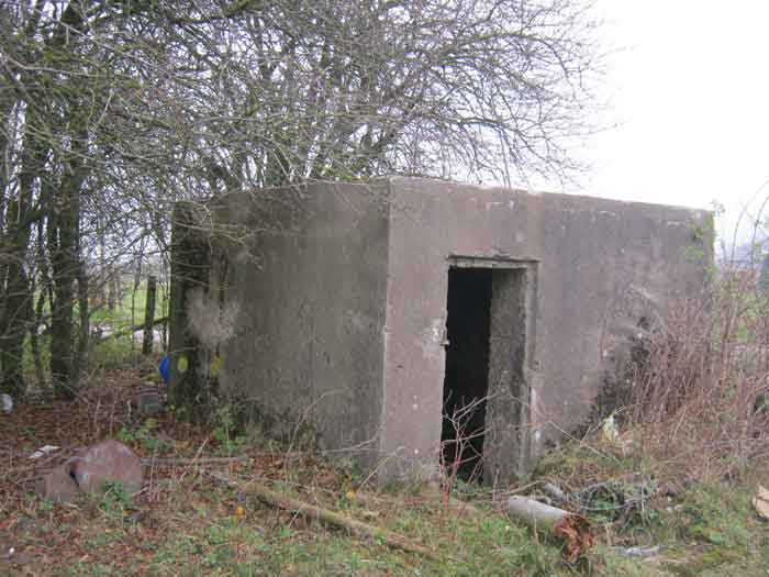
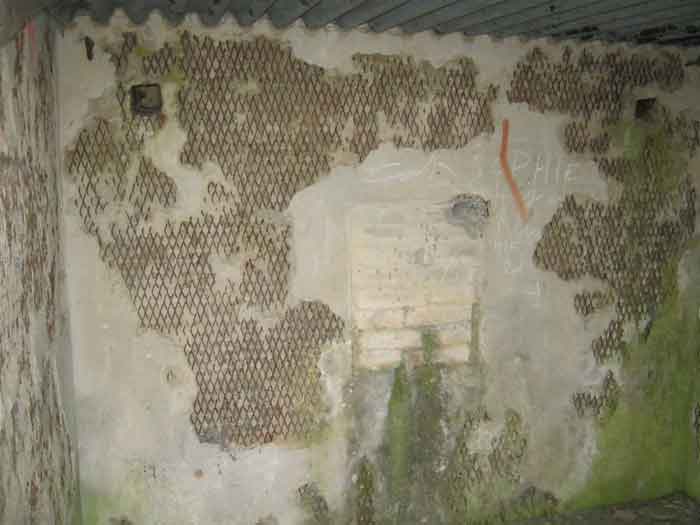
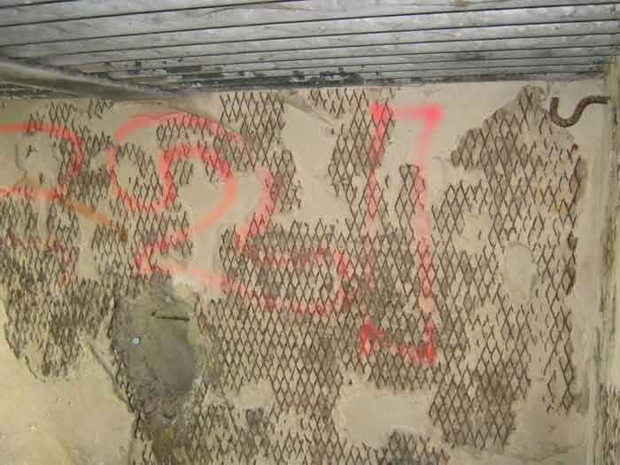
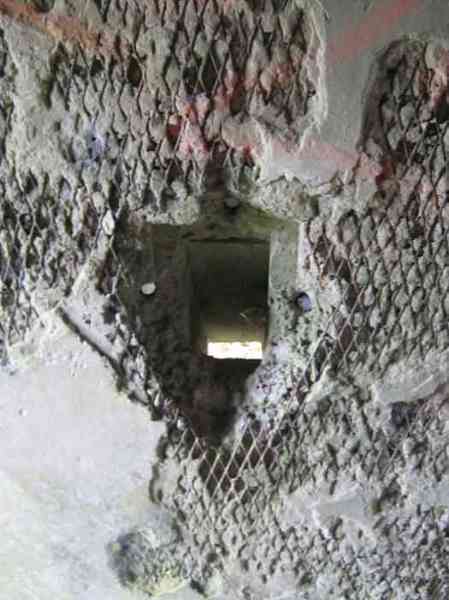
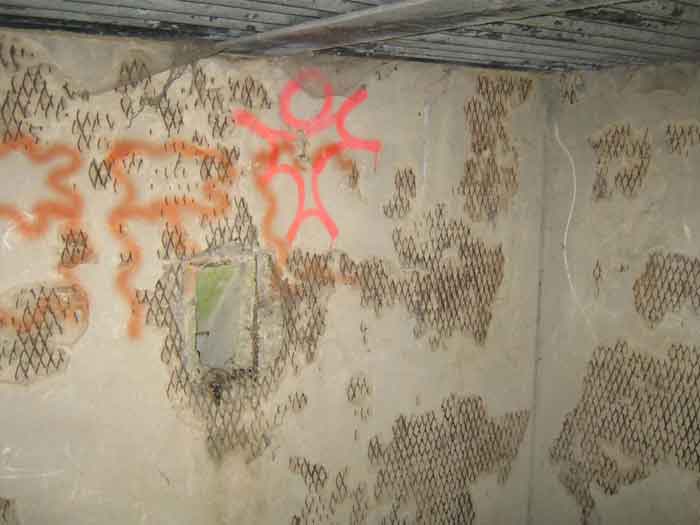
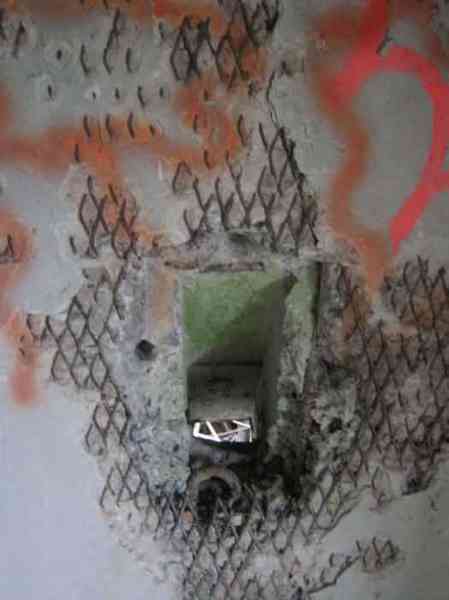
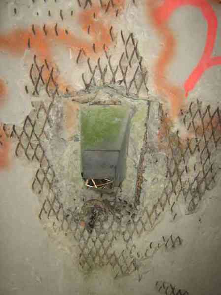
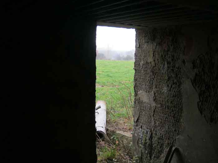
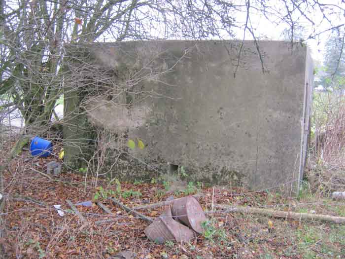
Bourcy 4 se trouve au nord du village, sur la route allant du cimetière (200 m) au terrain de football. Il couvrait la route de Rachamps. L’embrasure, murée, avait un volet pivotant maintenant disparu et dont il reste les gonds. L’entrée est accessible. Support pour affût et affût Chardome disparu, il ne reste que le pivot avant. Deux goulottes lance‑grenades défendaient les côtés latéraux, leurs volets de fermeture ont disparu. Deux grilles sur les bouches d’évacuation des gaz et fumées de combustion des poudres. L’abri doit servir de lieu de rencontre des jeunes du village qui y laissent traîner quelques détritus.
Bourcy 4 befindet sich nördlich des Dorfes, auf der Straße vom Friedhof (200 m) zum Fußballplatz. Er deckte die Straße von Rachamps ab. Die Schießscharte, zugemauert, hatte einen Schwenkladen, der nun verschwunden ist und von dem noch die Bänder übrig sind. Der Eingang ist zugänglich. Halterung für Lafette und Chardome‑Lafette verschwunden, nur der vordere Drehzapfen ist übrig. Zwei Granatwurfschleusen verteidigten die Längsseiten, ihre Verschlussklappen sind verschwunden. Zwei Gitter an den Abluftöffnungen für die Gase und Pulverrauchgase. Der Unterstand dient wohl als Treffpunkt der Dorfjugend, die dort ein paar Abfälle hinterlässt.
Bourcy 4 bevindt zich ten noorden van het dorp, op de weg van het kerkhof (200 m) naar het voetbalveld. Hij bestreek de weg van Rachamps. Het schietgat, dichtgemetseld, had een draaiende luik die nu verdwenen is en waarvan de scharnieren nog overblijven. De ingang is toegankelijk. Steun voor affuit en Chardôme‑affuit verdwenen, alleen de voorste draaipunt blijft over. Twee granaatgoten verdedigden de zijkanten, hun sluitkleppen zijn verdwenen. Twee roosters op de afvoeropeningen voor de gassen en rook van de buskruitverbranding. De schuilkelder dient waarschijnlijk als ontmoetingsplaats voor de dorpsjeugd die er wat afval achterlaat.
Bourcy 4 is located north of the village, on the road from the cemetery (200 m) to the football field. It covered the road to Rachamps. The embrasure, walled up, had a pivoting shutter now disappeared, of which the hinges remain. The entrance is accessible. Support for mount and Chardome mount disappeared, only the front pivot remains. Two grenade chutes defended the lateral sides, their shutters have disappeared. Two grilles on the exhaust openings for the gases and powder combustion fumes. The shelter probably serves as a meeting place for the village youths who leave a few rubbish items there.
Bourcy 4 se nachází severně od vesnice, na silnici od hřbitova (200 m) k fotbalovému hřišti. Kryl silnici do Rachamps. Střílna, zazděná, měla výklopnou klapku, která nyní zmizela a z níž zůstaly závěsy. Vchod je přístupný. Podpěra pro lafetu a lafeta Chardôme zmizely, zůstal pouze přední otočný čep. Dva granátové skluzy bránily boční strany, jejich uzavírací klapky zmizely. Dvě mřížky na výfukových otvorech pro plyny a kouř ze spalování prachu. Bunkr pravděpodobně slouží jako místo setkávání mládeže z vesnice, která tam nechává několik odpadků.
© Francis Pluymers